Dear customer,
we´ve moved! You can find our new branch office here:
contact

 Current Projects

our Flyer (pdf)

 
2003 - 2011

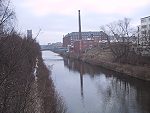
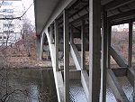
Teltow Canal Berlin


Geodetic documentation measurements in the context of developing Berlin’s waterways:
southern-route planning procedure for Section 6, Lot 2; 23.2 to 25.55 km

Teltow Canal Berlin

Teltow Canal Berlin
GPS survey of approx. fourty grid points forming a local grid for evidentiary documentation and site survey in the grid 42/83.
Combined GPS and (TCA-2003) tacheometric survey, creating a local building-related grid for evidentiary documentation.
For each building complex at least four horizontal and vertical points will be established, providing a basis for the points to be observed.
The evaluation and precise examination of the above surveys will be carried out using PANDA equalisation software, permitting transfer of the original data.
Levelling across the entire project area.
Making gradient measurements with a clinometer specially developed for monitoring buildings. Console mounts are attached, making it possible to combine tacheometric surveying with the relative measuring method and to work with a centred base.

The combination of GPS surveys, levelling, tacheometric surveying methods and relative measuring method chosen here ensures the required accuracy.


References - Graphic Data Processing Contact
 
Print ->
Print